If you are looking for a walk close to home without the bother of driving and finding parking, try the convenient, close to home, Lynn Valley LINK.
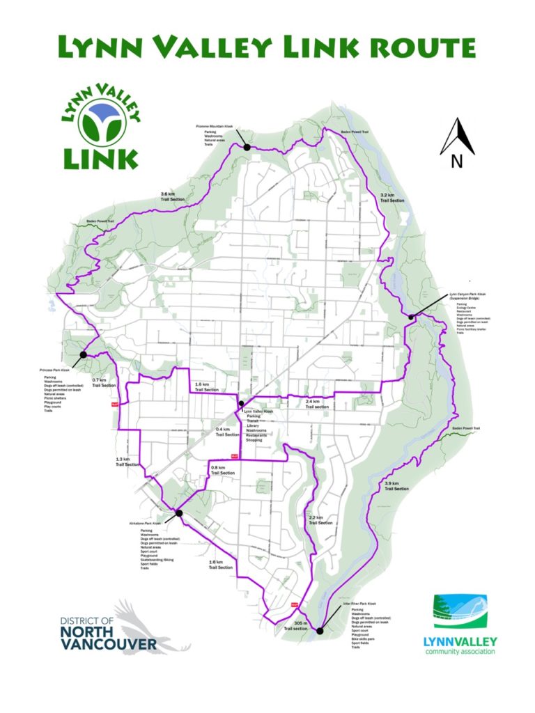
Phase 1 of the Lynn Valley LINK, a project initiated by the LVCA, opened in September 2017 using existing trails and streets to circumnavigate the community of Lynn Valley.
Phase 2 of the Lynn Valley LINK was completed in 2019. You might have noticed the LV LINK logos with arrows that show the routes through Lynn Valley that connect with the perimeter sections of the LV LINK.
The final map showing the connecting LV LINK routes through Lynn Valley is available on the LVCA website to download as a PDF. (see link at the bottom of this post)
The LV LINK kiosk installed at Pioneer Park in the heart of Lynn Valley at the corner of Mountain Highway and Lynn Valley Road features the map and is accessible to all at this location. Each kiosk along the LV LINK showcases the LV LINK Route Map and some interesting facts related to the history of Lynn Valley.
Enjoy your walk!
LYNN VALLEY LINK MAP – DOWNLOAD PDF