Hover over image to zoom
Hover over image to zoom

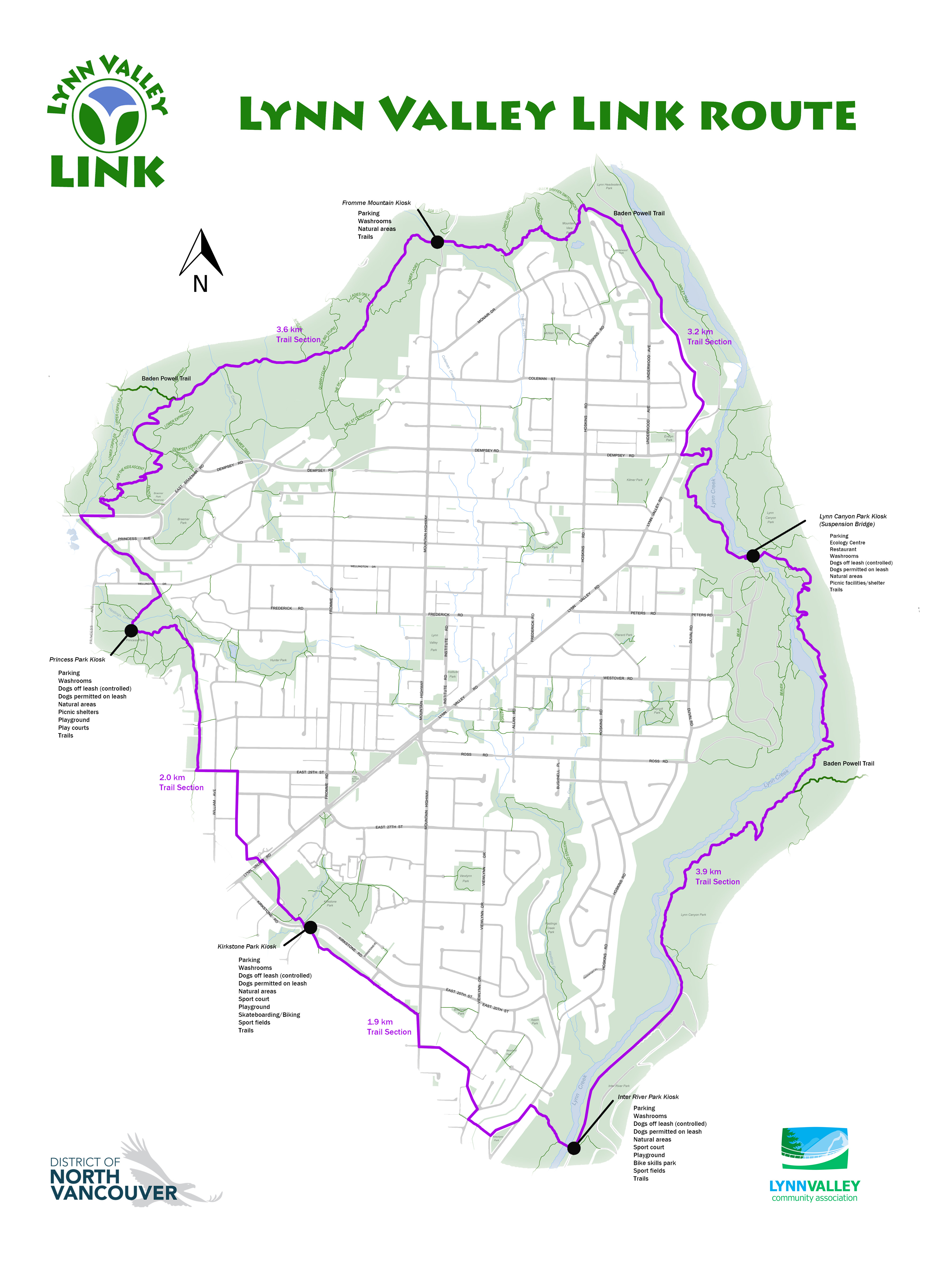
The Lynn Valley LINK is to showcase the depth and breadth of existing trails and provide an overview of the trail network in Lynn Valley by focusing on the connections around and through the community.
The LINK will connect existing circumference trails in Lynn Valley such as the Baden Powell and Power Line Trails, and will feature alternative routes from these trails to bring both residents and visitors to the restaurants and commercial centre.
The Lynn Valley LINK Committee, composed of DNV Parks staff and LVCA members, wants to update the trail’s supporters and the Lynn Valley public with the progress to date on the previously named Lynn Valley Loop Trail. The LINK was approved by DNV Council in 2016 and work has been progressing steadily since to make the LINK a reality.
The project has been divided into two phases:
2017 – Phase 1: Connecting Perimeter Trails around Lynn Valley.
2018 – Phase 2: Connecting Trails through Lynn Valley.
The Phase 1 Perimeter Trail is mostly in place. The only outstanding area to be finalized is in the northwest area where the LV LINK comes off the Baden Powell Trail and then joins up with the Power Line Trail. A suitable route is being determined that will not conflict with the heavy mountain bike use and trails in the northwest area.
Kiosk signage at five main staging and parking areas have been designed by the DNV and the LVCA is providing historical content that will reflect some of the history of the various areas of Lynn Valley. Suitable photos are being selected from the North Vancouver Archives.
Trail signage will feature the LINK logo and is easily consistent and distinguishable from other trail signage. Current trail signage will remain. Parks employees expect to have the LINK perimeter trail signage in place by the end of summer 2017.
While the current budget will get the project started, the committee is also working on fundraising for the Lynn Valley LINK.
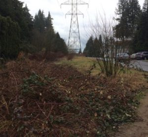
On May 13, 2017 the annual Lynn Valley Park Project will focus on the Power Line section (near Mountain Highway) of the LINK that needs restoration.
The Lynn Valley Community Association and the Lynn Valley Seniors Association are working together on the 2017 Lynn Valley Annual Park Project.
The location this year is the section of the Power Line Trail between Cedar Village Crescent and Mountain Highway, south of Kirkstone Road. Parking is available along Cedar Village Crescent. The Power Line Trail is a key component of the new Lynn Valley LINK which will go around and through Lynn Valley.
The Park Project will take place on:
The focus of this community event will be on restoring this section of the trail under the Power Line. District crews with heavy equipment will go in ahead of time to restore the path and remove some of the major invasive species that have taken over. Then we will be doing basic gardening work, removing invasive plants, planting natural vegetation, cleaning litter and anything else that needs to be done with the direction and support of the DNV Parks Department.
Do join us for this fun and productive day. We have work for every level of physical ability but we won’t let anyone overdo it. Dress for the weather, as this is a rain-or-shine event! Sturdy boots or shoes, working clothes and gloves are recommended, as it could be muddy! Coffee and snacks will be provided but please bring your own water bottle.
For information, call Suzanne at 604 984 8401.
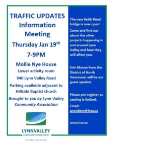
The Lynn Valley Community Association hosted a public traffic information meeting at the Mollie Nye House on Thursday evening, 19th January 2017. Thanks to everyone who attended – we had a full house!
The following is a summary of the question/answer/comments session which followed the power point presentation. Those taking questions included: Jane Thornthwhaite, MLA; Roger Bassam and Robin Hicks, DNV Councillors; Gavin Joyce and Erin Moxon, DNV staff. Speakers contact information is at the end of the summary.
The evening was moderated by Gillian Konst, president of the LVCA.
Questions have been grouped to reflect discussion. Not all points or suggestions are captured here.
Lynn Valley Road Highway One Underpass:
Q: Regarding the under/overpass (Lynn Valley Road onto Highway 1), what is the priority regarding the new lanes? Concern noted about driveways being blocked and access being difficult during any construction process.
A: Some of the land is in the City of North Vancouver, and the District will receive grants from the provincial and federal governments, so the bike lane will come later, even if that does not seem to make sense at the moment.
Underpass widening:
BOSA is also contributing to the cost of the Lynn Valley Road improvements. The road will be wider with a dedicated bike lane.
Q: Why did bike lanes get done first?
A: DNV needs to take advantage of provincial funding – timing out of DNV control and is also tied to BOSA developments.
Q: Improvements at the underpass are to take place at the same time as Lower Lynn work – this will cause a lot more disruption – why is it being done at the same time?
A: The work at Mountain Highway interchange and Main Street will be phased into the interchange: improvements are provincial. The BOSA part of the improvements will be complete before the larger project starts.
NOTE: There is a construction traffic management team at DNV that coordinates the movement of construction vehicles which helps to alleviate the issue of all vehicles moving along the main core at the same time. This team ensures that routes into LV are not impacted at same time as development traffic.
Some changes are taking place in the building process. There are increased charges to contractors, and developers are being told when they cannot work due to overlaps anticipated.
NOTE: A later question was asked re: connecting LV on ramp with the Lonsdale off ramp on highway #1. This is a provincial responsibility, and nothing planned at the moment. The DNV is asking for improvements all the way to Horseshoe Bay.
27th – The Branches
Q: Will 27th be widened to allow buses? What about street parking? It is currently very congested due to the BOSA development.
A: $1.7 million has been received in community amenity costs from BOSA.
There will be a bus depot (for the mini community buses) in this area. There are three phases to this project, and we are in phase 2 now. Acquiring the land takes time.
The intention is to widen 27th in due course.
Costs:
Q: The costs for the interchange upgrades are now in the region of $200 million dollars. How is this divided?
A: For the widening of the bridge on Keith Road, it is a three way split, with the District giving the land as most of its contribution.
Q: Why is the City of North Van not contributing financially to the improvements?
A: They have other priorities. DNV does need to partner as much as possible, so in this case the province and federal governments are the ones to partner with.
NOTE: Please keep an eye out for information on Ministry of Transportation and Infrastructure and the DNV website for updates.
Bridge access:
Q: What are the improvements to the Iron Workers Bridge going to look like?
A: The current slide (in power point) has not been updated to reflect the many changes in the layout of the upcoming road systems. For example: improved interchanges away from the bridge to get from Seymour to Lynn Valley or beyond (going west) means there will no longer be a need to use the highway for local traffic. This will improve traffic flow in the bridge head area as well as Lower Lynn. There is a great deal of consultation with province and federal governments to push for this as a solution to current concerns. Many of the criss-cross/weaving effects of the current system will be eliminated. It is estimated that 20% of vehicles coming down the cut will be exiting before the bridge to go towards Seymour
Development:
Q: Rate of development is causing extra traffic, stress and anxiety for everyone. How will these changes address that?
A: We need development. Single homes are being replaced. We need to create affordability if we are to keep residents in their communities of choice rather than necessity. More use of public transport; traffic patterns in the 1990’s were the same as they are now (people work in Vancouver, but live on the NS); we need to provide opportunities for work on the NS; local, low-paying jobs do not allow you to live here; there is a cascade of downsizing to townhomes; growth in community to be absorbed in town centres; we will have 20 years of “mess” until it is all finished.
Truck Lane
Q: Trucks do not stick to their designated curb lane on the bridge. Can we ask the RCMP to start monitoring this and enforce the rule?
A: The DNV is working with the RCMP and MoTI on a variety of issues.
LV Road:
Q: Left turns lanes have been excluded since bike lane work started – will they be re-instated?
A: Yes they will, and there will be 200 trees planted to replace the old and dying ones that were removed for the bike lane construction. The trees that were removed were in very poor shape. EXTRA comment – some left turn lanes will be extended to accommodate a few more vehicles.
“The Cut”:
Q: What is the plan for “the cut”? The constant reporting of traffic backing up is affecting our reputation, our businesses. Can the bridge be expanded eventually? The gutter pan and gravel shoulders create problems and can be the cause of crashes; there is no medium; inferior barriers; it is dangerous and is part of the reason there are huge line ups when there is a crash. This needs to be considered as an urgent matter.
A: A corridor study will be done. This may include staggering the flow; road pricing (tolls); solutions to get back to livability.
General comments:
Add the NVC App to the DNV website site so residents know what to expect there too.
(APP for locating developments is on The DNV site, noted on power point)
Please consider roundabouts – they take up space but are more cost effective than traffic lights
Road signs are inadequate – The DNV should review global standards for a variety of directional information, especially look at those used in Europe.
Future planning: Phibbs exchange to be replaced; Sea bus to be expanded.
Mayor Walton is part of the Mayors committee, but we are a relatively small population (200,000) on the North Shore compared with other parts of the lower mainland, so sometimes our priorities are not top of mind to others!
The Translink Plan is way overdue (2004) and a lot of the changes needed are based on engineering decisions.
North Shore is seen as a “cash cow” for transit.
We don’t have enough transit for current and future residents, but we don’t have density either.
Final comment from long-time resident:
We have a great transit system in place now, actually. Not too long ago we had to wait two hours for a bus to go to Vancouver, now we only must wait a few minutes.
NOTE: Ms. Thornthwhaite informed the meetings that there will be an updated public announcement on the progress and process re: the interchange on January 27th.
Contact the speakers:
Jane Thornthwaite, MLA (by email)
Gavin Joyce and Erin Moxon – include a note that you wish your e-mail to be forwarded to them.
Eoe
January 27th 2017
PowerPoint: